Trail Proposal for Briarwyck Park
Executive Summmary
Vernfield is one of Lower Salford Township's historic villages, yet it does not enjoy the same degree of comfortable, off-road connection to the township’s broader trail system that residents in other areas can use. A thoughtfully planned trail through Vernfield, with a dedicated bridge over Indian Creek to Briarwyck Park and it's other trail connections, could close a substantial gap.
Overview
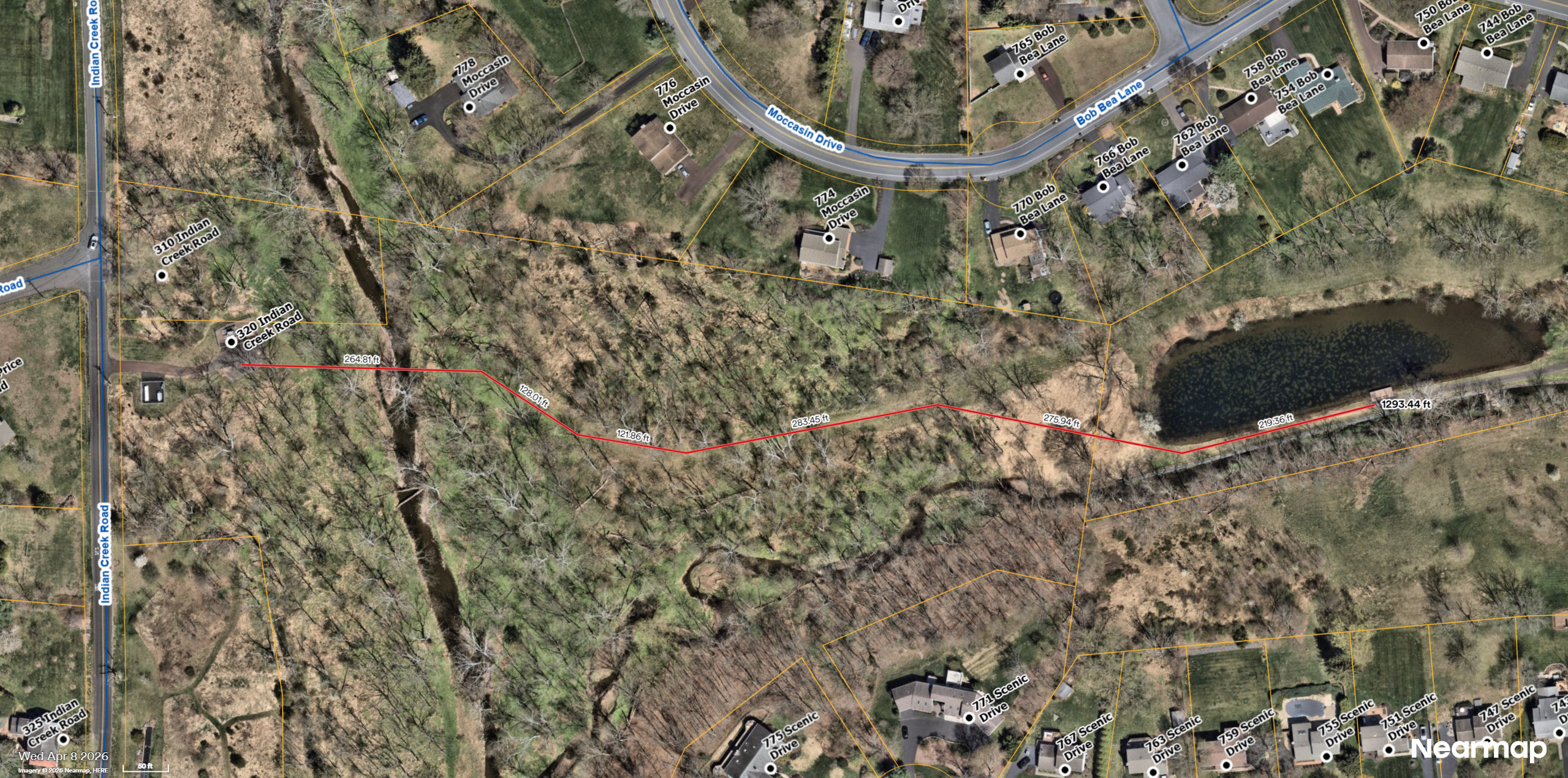
This proposed trail would extend from Indian Creek Road roughly across from the intersection with Price Road, through Lower Salford township property with a small pedestrian bridge over the Indian Creek and continuing at an already proposed trail segment which follows undeveloped space sitting over a LSTA sewer pipe leading up to and through the Briarwyck Park area.
With a 25 mile-per-hour speed limit across Indian Creek Road, this would provide a safe family-friendly connection to built and proposed trail systems extending into the shopping center at the intersection of Sumneytown Pike and Shelly Road in Upper Salford all the way to the larger Lower Salford trail system beginning at Old Sumneytown Pike.
Neighborhoods Affected
This document uses the Village of Vernfield as a stand-in for the specific areas. This trail would specifically connect the neighborhoods of Smith's Corner, the Estates at Indian Creek, and the property of the Covenant Presbyterian Church to the larger trail system of Lower Salford Township.
This area includes the local residental streets of Covenant Lane, Arrowhead Lane, Price Road, Homestead Drive, and Indian Creek Road.
Background
Lower Salford promotes an extensive system of multi-use trails made possible by extensive township-owned open space.
Indian Creek is both a defining natural feature and a physical barrier. A purpose-built pedestrian and bicycle bridge would allow the trail to cross the creek away from motor-vehicle traffic.
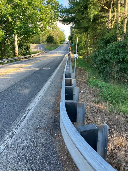
The only reasonable place for a pedestrian and bicycle to currently cross Indian Creek is a vehicle bridge on PA Route 63 which was designed and installed without safe pedestrian access. Shoulder area between the roadway and metal barriers is only around two feet wide.
In May 2026, Lower Salford voters approved the open-space referendum by 3,130 votes to 680. In August 2026, the Township created an Open Space/Trails Committee whose stated work includes trail connections, environmental stewardship, and recommendations developed with staff, elected officials, and community partners. This timing is favorable to the creation of new trails.
Benefits
This proposed trail connection would:
- Provide an off-road alternative where existing roads, shoulders, intersections, or creek crossings are uncomfortable for people walking or bicycling.
- Link Vernfield more effectively with nearby neighborhoods, a local park, and the larger township trail network.
- Create responsible public access to Indian Creek while using design and signage to protect streambanks.
- Secure a corridor while opportunities exist, so future boards and residents retain the option to connect future trails and development with walkable infrastructure.
Conclusion
Lower Salford should act now to study and preserve a trail connection through Vernfield, including a safe bridge over Indian Creek. The township should protect the opportunity, establish the facts, involve affected residents, and develop a feasible project that can be funded and built responsibly.
References
Signed document
This page has a detached OpenPGP signature. Download both files to verify that the Markdown source has not been changed by anyone but the author.
gpg --verify index.md.asc index.md